

A piece of space debris can cross the sky at several kilometres per second, disappear beyond the horizon, and return less than two hours later. Yet operators may still know where it is expected to be days from now. The trick is not to watch every object continuously. It is to measure it repeatedly, calculate its orbit, and keep correcting that prediction as new observations arrive.
That job has become much larger as Earth orbit has filled up. ESA statistics updated on July 31, 2026 list about 46,950 space objects regularly tracked by surveillance networks and maintained in catalogues. That total includes working spacecraft as well as dead satellites, rocket bodies and fragments. Millions of smaller pieces are believed to exist beyond the practical limits of routine tracking, so the catalogue is only the visible part of the debris environment.
Radar and Telescopes Catch Brief Glimpses of Objects
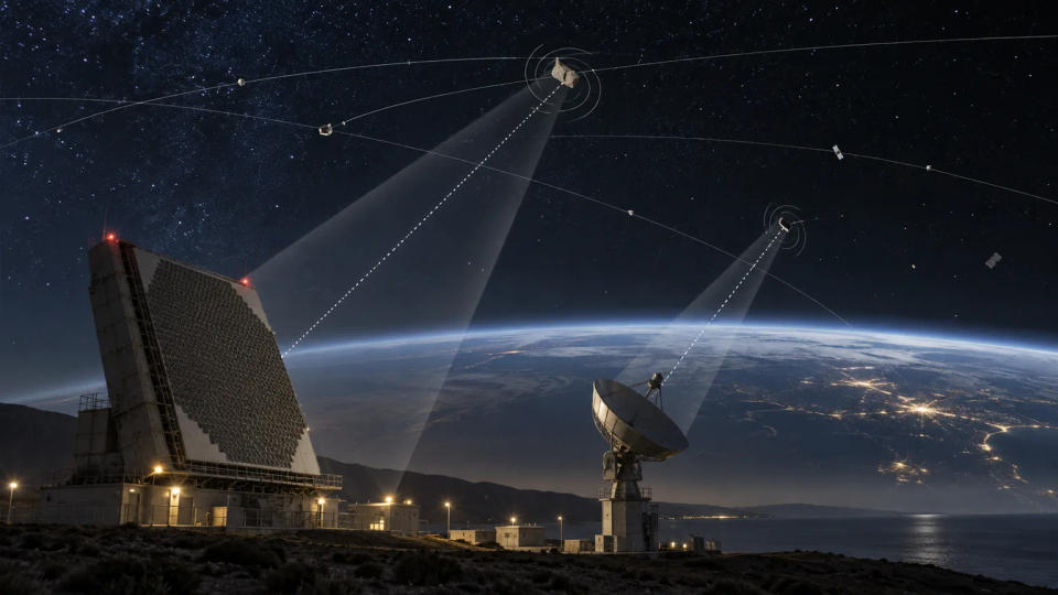
Tracking starts with sensors on the ground and, in some systems, in space. Radar is especially useful in low Earth orbit. A radar sends radio waves upward and measures the echo from an object. The return time gives range, while changes in the signal can reveal how quickly the target is moving toward or away from the sensor. Modern phased-array radars can steer their beams electronically, allowing them to search large areas of sky and revisit known objects quickly.
Optical telescopes do a different job. They photograph or measure objects against the background stars, recording precise directions and often brightness. They are particularly valuable at higher altitudes, where radar echoes become much weaker. Optical systems work best under dark, clear skies, while radar can operate day or night and is far less dependent on visible-light conditions.
No single station can see everything. Earth itself blocks the view, and an object may be visible from one continent while hidden from another. That is why space-surveillance systems combine measurements from networks spread across different longitudes and latitudes. ESA notes that routine surveillance can generally catalogue objects larger than roughly 5–10 centimetres in low orbit and about 0.3–1 metre near geostationary altitude, although the exact limit depends on the sensor and object.
One Detection Is Not Enough to Know What You Saw
A radar echo or telescope streak is only an observation. The next challenge is deciding which object produced it. Computers compare the new measurement with predicted positions for objects already in the catalogue. If the observation matches an existing orbit closely enough, it can be associated with that object and used to refine its future path.
New fragments are harder. After a satellite breakup or collision, sensors may suddenly detect many short, uncorrelated tracks. Analysts and software must work out which observations belong to the same physical fragment. Multiple detections, taken at different times and sometimes by different sensors, are combined until there is enough information to estimate an orbit. Only then can a new object be reliably added to a catalogue.
This process is called orbit determination. It turns scattered measurements into a best estimate of an object's position and velocity at a particular time. Every new observation can sharpen that estimate. If a fragment is missed for too long, however, the uncertainty grows and sensors may need a wider search to find it again.
The Catalogue Is Really a Set of Constantly Updated Predictions
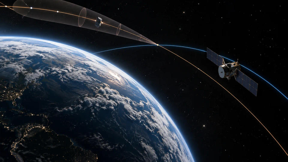
An orbital catalogue is not a giant map of fixed dots. Each entry is a prediction that changes with time. Gravity is the main force, but real orbits are also nudged by Earth's uneven gravity field, atmospheric drag, the gravity of the Moon and Sun, solar radiation pressure and, for active spacecraft, deliberate manoeuvres.
Low-orbiting debris is especially sensitive to atmospheric drag. The upper atmosphere expands and contracts as solar activity changes, so a small change in density can alter how quickly an object loses altitude. Irregularly shaped fragments can also react differently depending on their orientation. These effects mean that even a well-measured orbit develops uncertainty as it is projected farther into the future.
Modern tracking systems therefore keep scheduling new observations where they will reduce uncertainty the most. The U.S. Space Force's Advance Tracking and Launch Analysis System, or ATLAS, shows the scale of this data-processing task. In April 2026, the Space Force reported that during roughly its first six months of operational use, ATLAS had processed more than 120 launches, catalogued more than 1,883 objects, handled at least 474 reentries and generated more than 22.4 million orbital element sets.
Collision Warnings Come From Screening Future Orbits
Once orbital estimates exist, computers can propagate them forward and compare them with the paths of active satellites. A predicted close approach is called a conjunction. The important question is not simply whether two lines cross on a screen. Analysts also consider when the objects arrive, how fast they pass one another and how uncertain each predicted position is.
That uncertainty matters because a predicted miss distance of a few hundred metres can mean very different things depending on how precisely both orbits are known. A well-observed object may have a relatively compact uncertainty region, while a poorly observed fragment may have a much larger one. As more tracking data comes in, the predicted encounter can move, become less threatening or sometimes become more concerning.
Satellite operators can use these warnings to decide whether a manoeuvre is justified. They may also provide their own precise orbit information, which can improve the calculation. There is no universal rule that every close approach triggers a burn: operators balance collision risk against fuel use, mission constraints and the possibility that the prediction will change with better data.
Why Millions of Smaller Fragments Cannot Be Tracked One by One
The biggest limitation is size. ESA's July 2026 statistics estimate about 1.5 million debris objects between 1 and 10 centimetres and roughly 230 million between 1 millimetre and 1 centimetre. Most are too small to maintain as individual catalogue entries, even though a fast-moving fragment can still damage or disable a spacecraft.
Scientists study this hidden population statistically. NASA uses specialized radars such as the Haystack Ultrawideband Satellite Imaging Radar and Goldstone Orbital Debris Radar to detect much smaller objects during dedicated observing campaigns. NASA reports that Haystack measurements can reach roughly 5 millimetres at 1,000 kilometres altitude, while Goldstone has detected objects around 2–3 millimetres below 1,000 kilometres. These observations reveal how many small fragments are present in a region, but they do not normally provide continuous tracks for each one.
For even smaller particles, researchers examine impact marks on spacecraft surfaces returned to Earth or use in-space detectors. The result is a hybrid picture: large objects are individually tracked and predicted, while the smaller population is described by measurements and statistical models.
Space-debris tracking is therefore less like watching traffic on a security camera and more like maintaining a constantly revised weather forecast for orbit. Sensors collect brief clues, computers turn them into trajectories, and new measurements keep those trajectories useful. The system cannot see every fragment, but for the objects it can follow, repeated observation makes a crowded and fast-moving environment far more predictable.
Post a Comment